The Northeast Regional Earth System Model
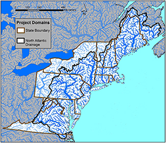
Study Region
The Northeast United States has a long history of significant environmental transformations, including:
- Early settlement by European colonizers with deforestation and land clearing to support agriculture (1600-1800).
- Industrialization, urbanization and mega-city growth (1800-1950).
- Post-industrialization and suburban sprawl (1950-Present).
|
|
This region encompasses the entire ‘Northeast Megalopolis’ and includes all of the area that drains into the North Atlantic between the Bay of Fundy and the Chesapeake Bay.
Spatial Units and Resolution
Numerical models operate by dividing the modeling domain area into multiple, homogenous sub-units with which calculations are performed. These sub-units can be rectangular grid cells (the most common), political units such as states or counties or physical units such as drainage basins. A model’s ‘spatial resolution’ specifies how large (in degrees of latitude and longitude or in km or miles) the grid cells in a model are.
The different components of the NE-RESM operate using different spatial units:
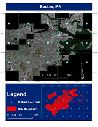
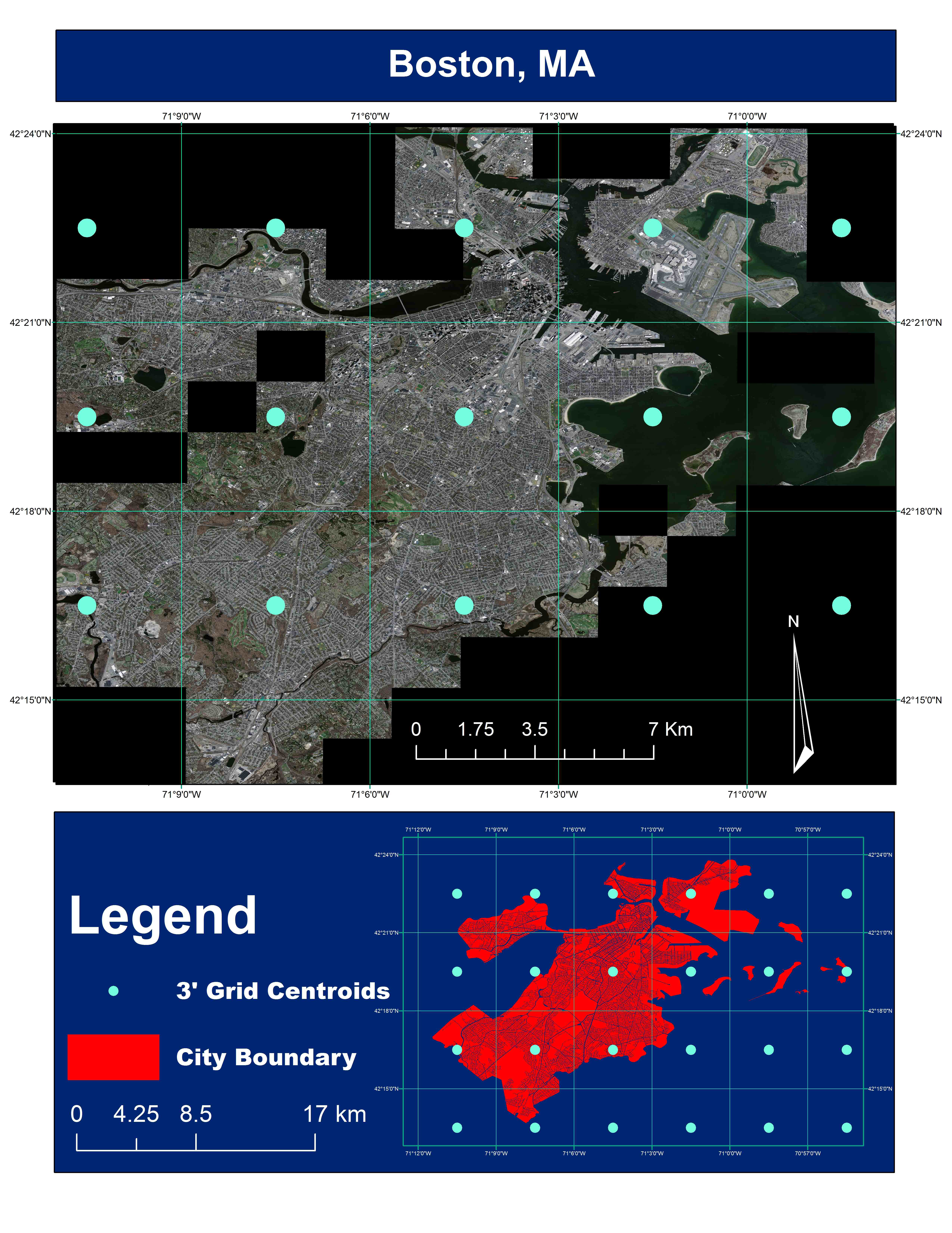
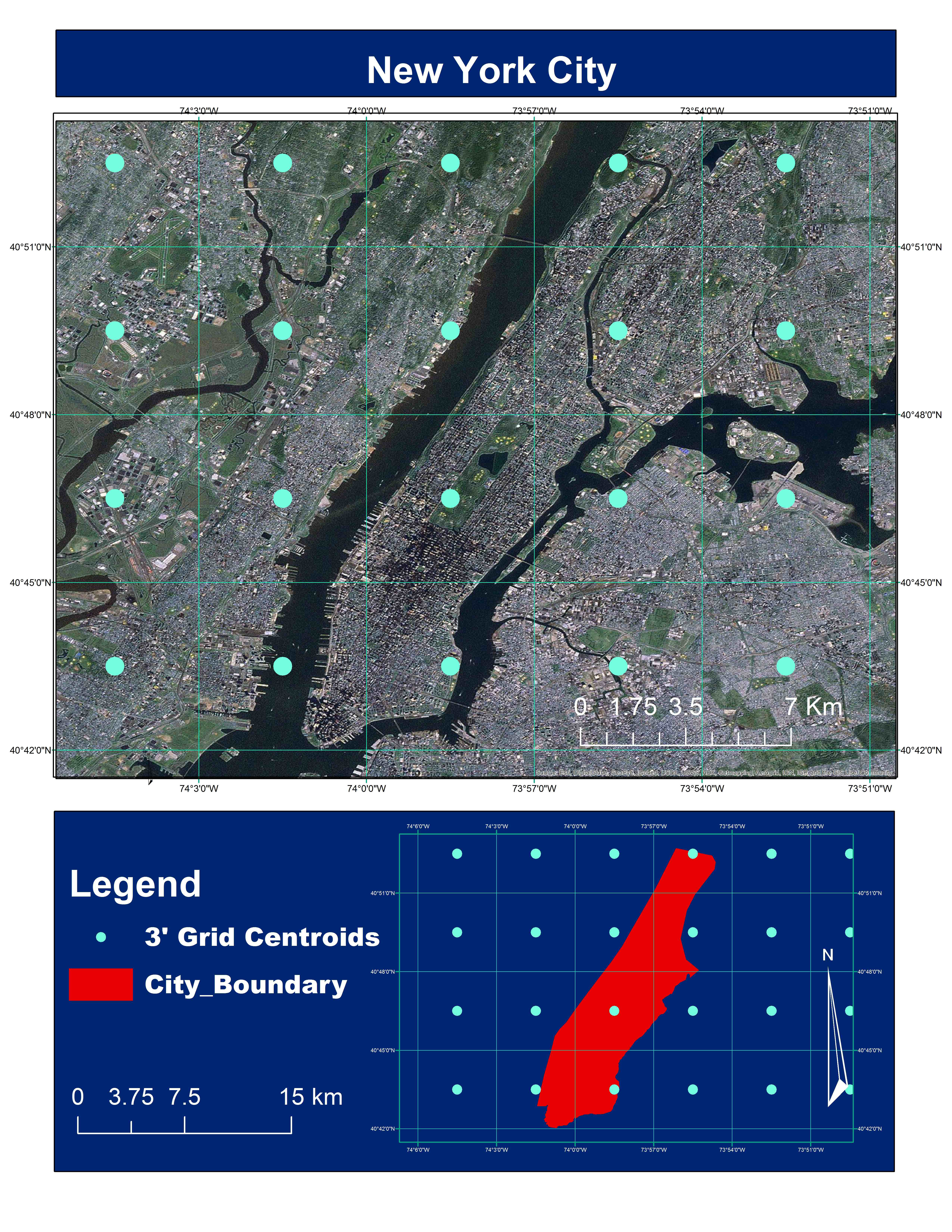
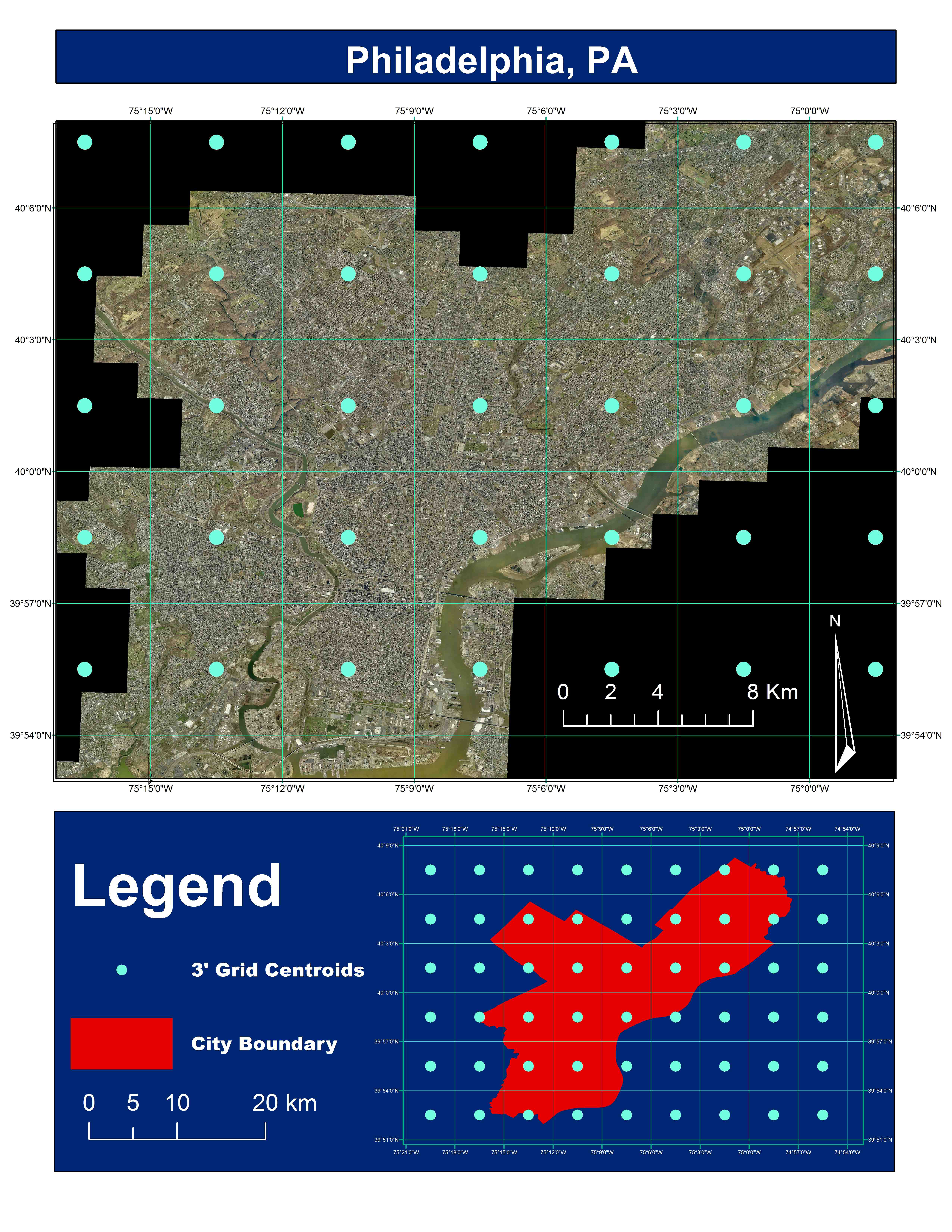
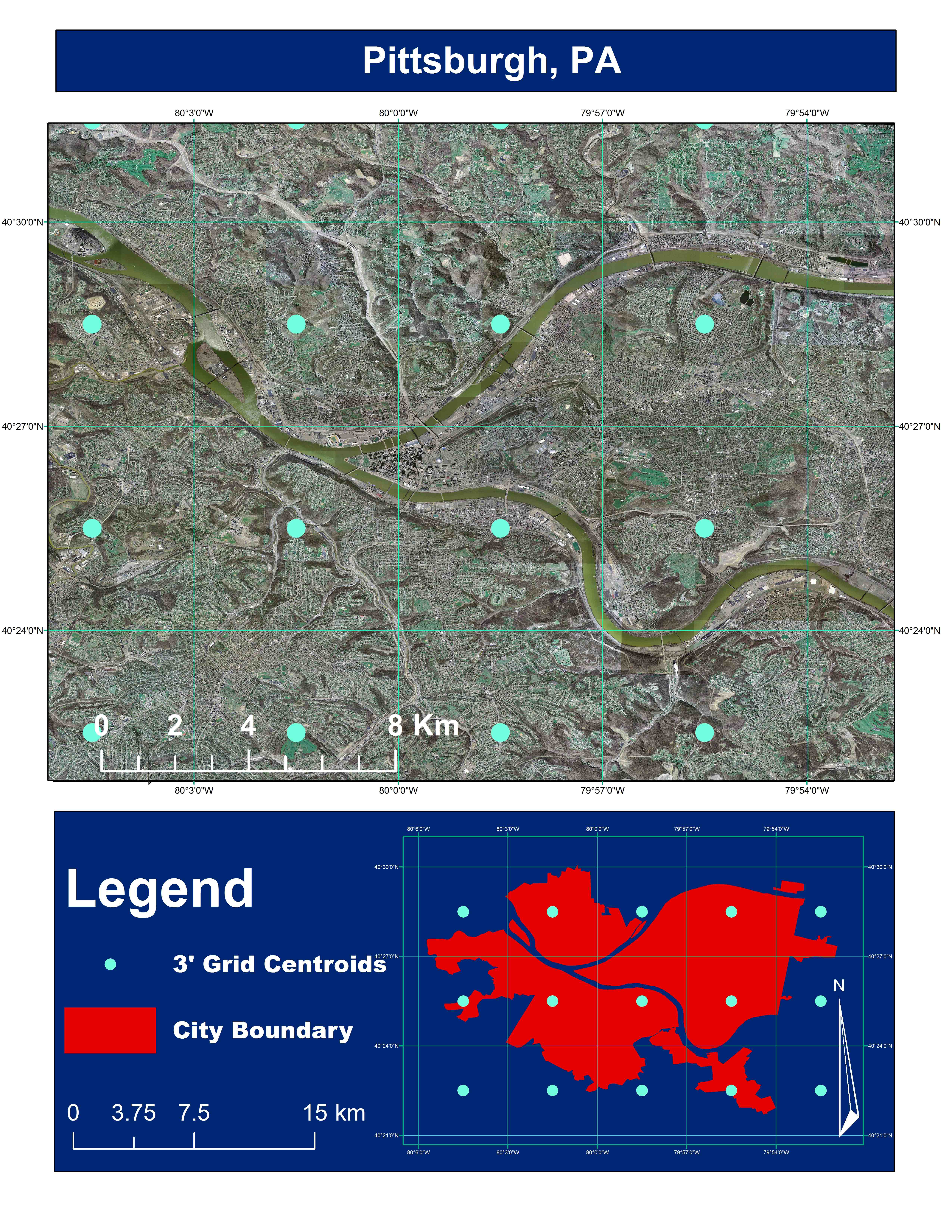
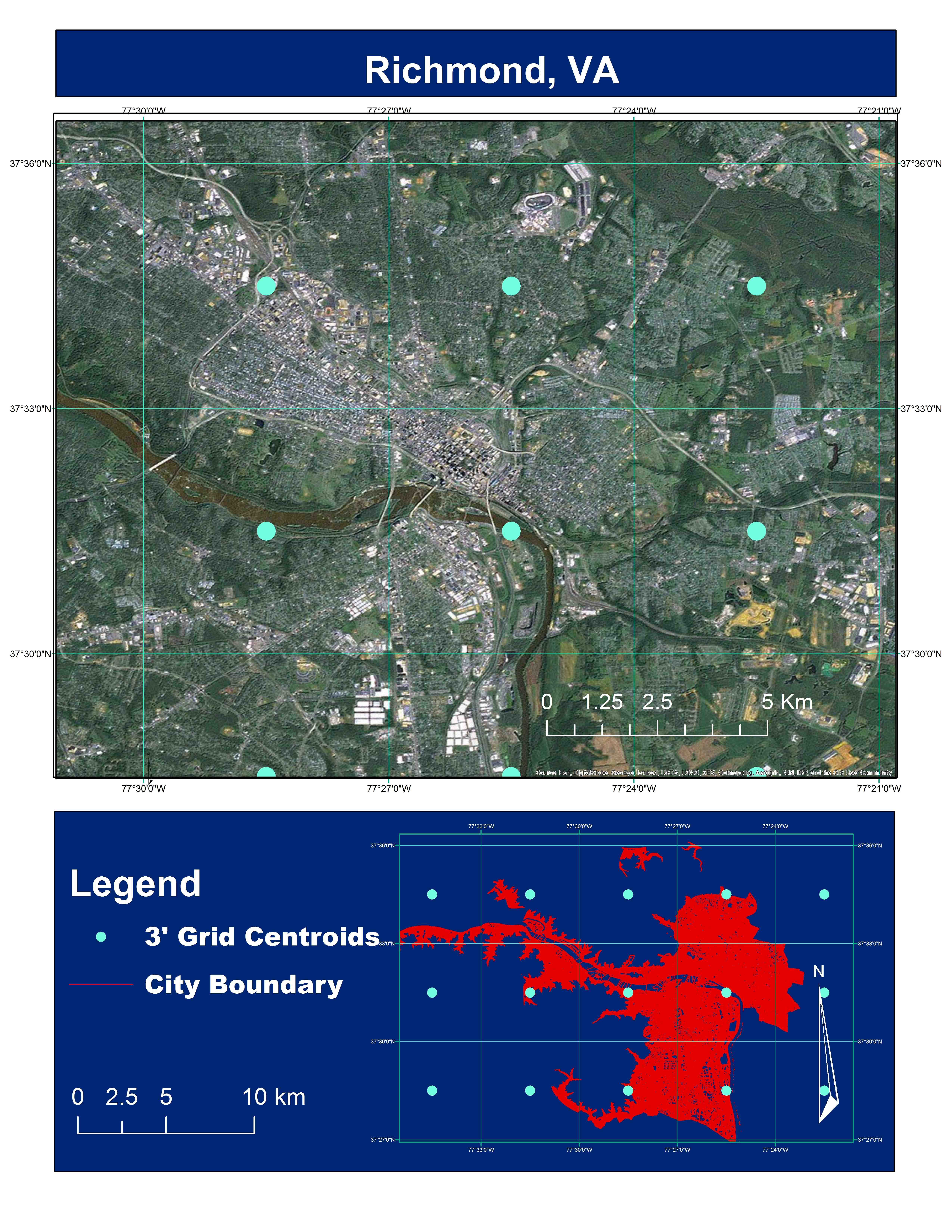
- The biogeophysical modeling components (Atmospheric Dynamics, Aquatic Ecosystems and Terrestrial Ecosystems) use rectangular grids with 3-arc minute x 3-arc minute resolution. As a result, each grid cell ranges from 19 – 21 km2 in area. The 3-arc minute grid provides continuous coverage over the entire domain shown in the image. You can gain perspective on the size of the 3-minute grid cells by viewing examples that are ‘zoomed-in’ over several of the major cities of the Northeast using the links below:
- The WTM Mesoeconomic Model operates using state units (the District of Columbia and the 12-states that comprise the Northeast Megaregion).
- The NE-RESM uses the Regional Markal Energy Systems Model, which operates using Census Region subunits.

